The Holocene – ice age lakes
In the previous blog post, we introduced the concept of Deep Time and contrasted it with our human time horizon. We will now examine landscape changes that, while slow from a human perspective, occur rapidly compared to geological changes. To do this, we travel to the Black Forest and the Vosges.
There are 30 glacial cirque lakes – or tarns – in the Black Forest (Germany) and the Vosges (France). (Learn more)
More photographs of the glacial cirque lakes in the Black Forest and the Vosges
These lakes are relatively small and have an almost circular outline – with a maximum diameter of 200 meters. The Wildsee in the Black Forest National Park is one of them.
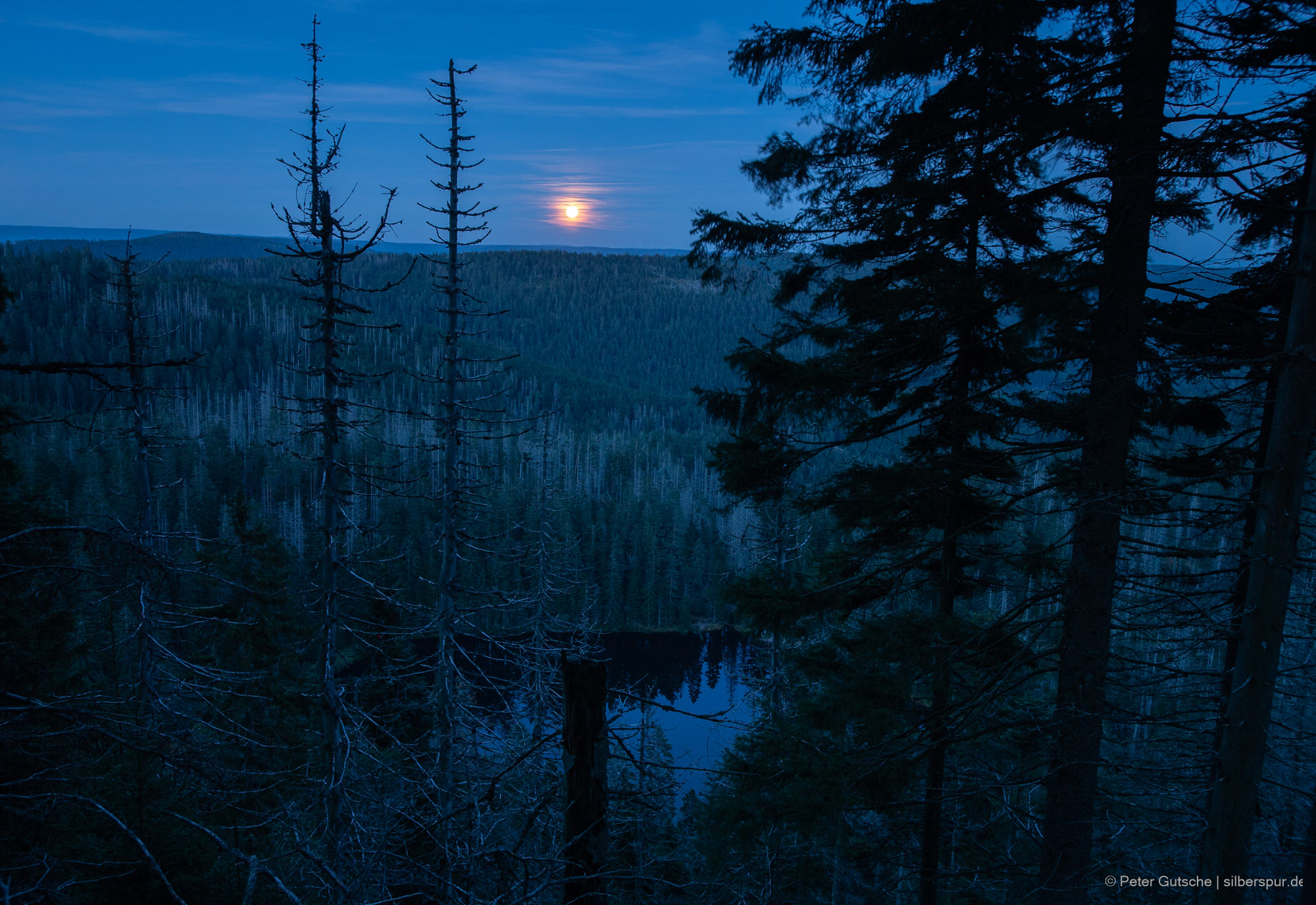
The formation of the tarns
These lakes are relicts of the last glacial period.
This epoch of Earth history lasted about 100 000 years and ended about 12 000 years ago. Within this period, the temperates changed to a certain extend, but overall a much colder climate dominated.
During the last glacial maximum, about 21 000 years ago, the highest regions of the Black Forest and the Vosges (about 1500 meters altitude) were covered by mighty glaciers.
On the highest mountains – like the Feldberg in the Black Forest – the ice cap was shaped as a relatively thin layer of firn. However, in the valleys that originated from these mountains glaciers several hundred meters thick formed. The map shows the situation as it appeared at that time (by courtesy of Dr. Charlotte Prud'homme, Université de Lorraine).
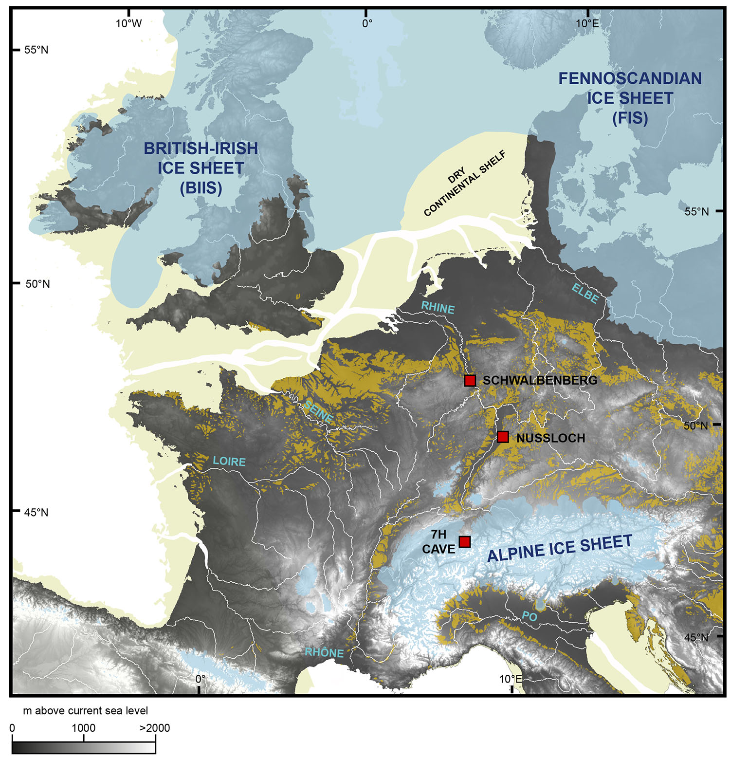
The map shows the expansion of the continental glaciers during the last glacial maximum about 21 000 years ago. (Learn more)
You can clearly spot the ice caps of the southern Black Forest and the Vosges. As a comparison: The glacier covering the Feldberg region in the southern Black Forest had a dimension comparable to the size of today's Hofsjökull glacier in Iceland.
Because of the map’s large spatial scale, the following details cannot be resolved: In the northern Black Forest, the Hornisgrinde massif (1160 meters above sea level, about 80 km north of the Feldberg) was covered by a small glacier, from which two smaller valley glaciers flowed eastward. (Learn more) At the other higher summits – in most cases on the northern and eastern slopes – individual firn areas formed. Even during summer, the ice didn’t melt there and, simply speaking, shaped depressions into the rock surface. In these depressions – also referred to as cirques – water accumulated after the glaciers melted down. On the opposite side of the slope, in many cases the ice had banked up a moraine that prevented the water from flowing downward into the valley.
That way, the glacial cirque lakes (tarns) were created. In the warmer phase following the last glaciation – an interglacial we call the Holocene – humans began to evolve as a settled species, learned how to practice agriculture and developed urban civilizations. (Learn more)
The whole part of human history from which we have written tradions at our disposal is located in the Holocene. This interglacial period is still ongoing today.
The following figure shows the Huzenbacher See in the Black Forest.
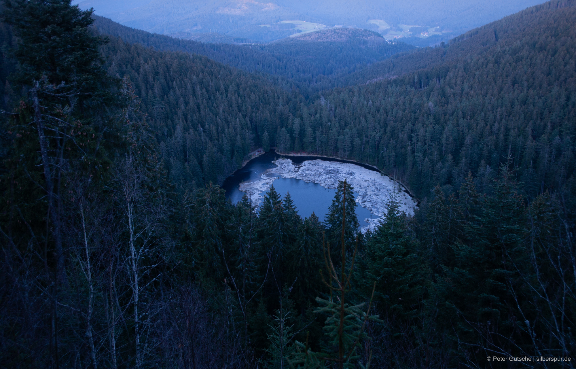
In this picture you can clearly recognize the typical landform of a glacial cirque. In a certain sense, the lake is nestled like on a sofa, whereas the backrest – from the highest point of which the photo was taken – is flanked by two ridges (the armrests) that extend away from the viewer towards the valley, starting at the opposite side of the slope.
It is plausible to assume that at the end of the last glaciation, there existed many more glacial cirque lakes than today. Presumably, in the northern Black Forest existed about 40 such lakes. Most of them disappeared during the Holocene through a process called siltation. During this process, a lake is transformed into a swamp and – finally – dries ou completely.
Siltation is the gradual filling of still waters with organic material. As plants slowly grow, the free water surface diminishes over time, and often floating islands of turf form which, in the course of time, are colonized by bushes and even trees. You can clearly see this in the photograph of the Huzenbacher See.
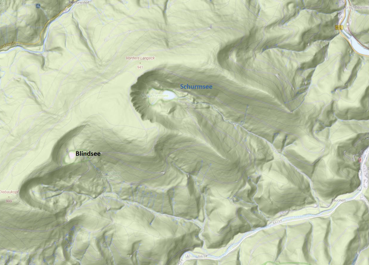
The depressions that no longer contain a lake still exist as well. These bowl-shaped landforms that are open on one side – glacial cirques – can be clearly identified on topographic maps.
The following map shows the topography of the region containing Huzenbacher See.
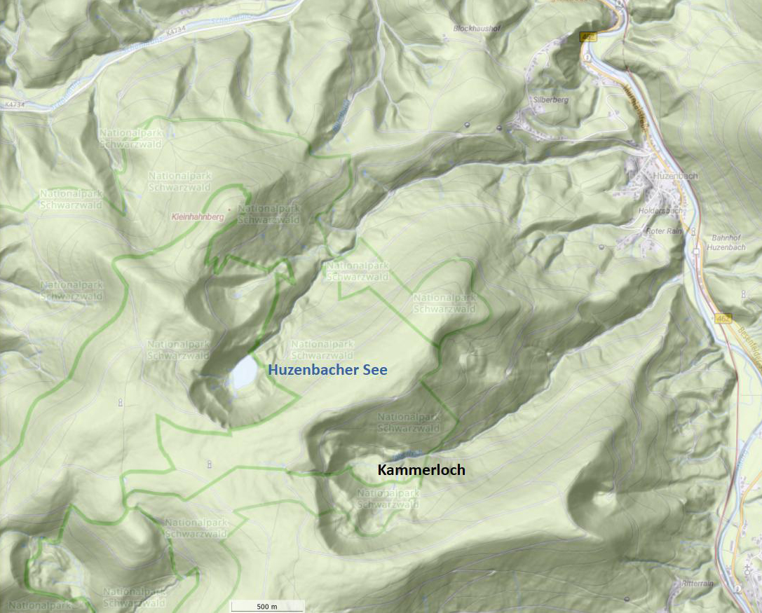
The form of the cirque can be compared to a crater opened to one side. South east of Huzenbacher See, you notice two further cirques. According to the geograph Fritz Fezer (Learn more), thousands of years ago these cirques housed lakes. We discuss this in detail in a minute.
An interesting detail: Most cirques in the Black Forest and the Vosges are open to the north or east. This is related to the fact that already during the last glaciation the wind mainly came from the west (Atlantic). As a result, the firn areas formed mainly at the northern or eastern slopes of the mountains – the leeside of the mountain.
The following photograph shows a view to the Kammerloch cirque marked on the previous map. The ground of this cirque is named Schwarzmiss.
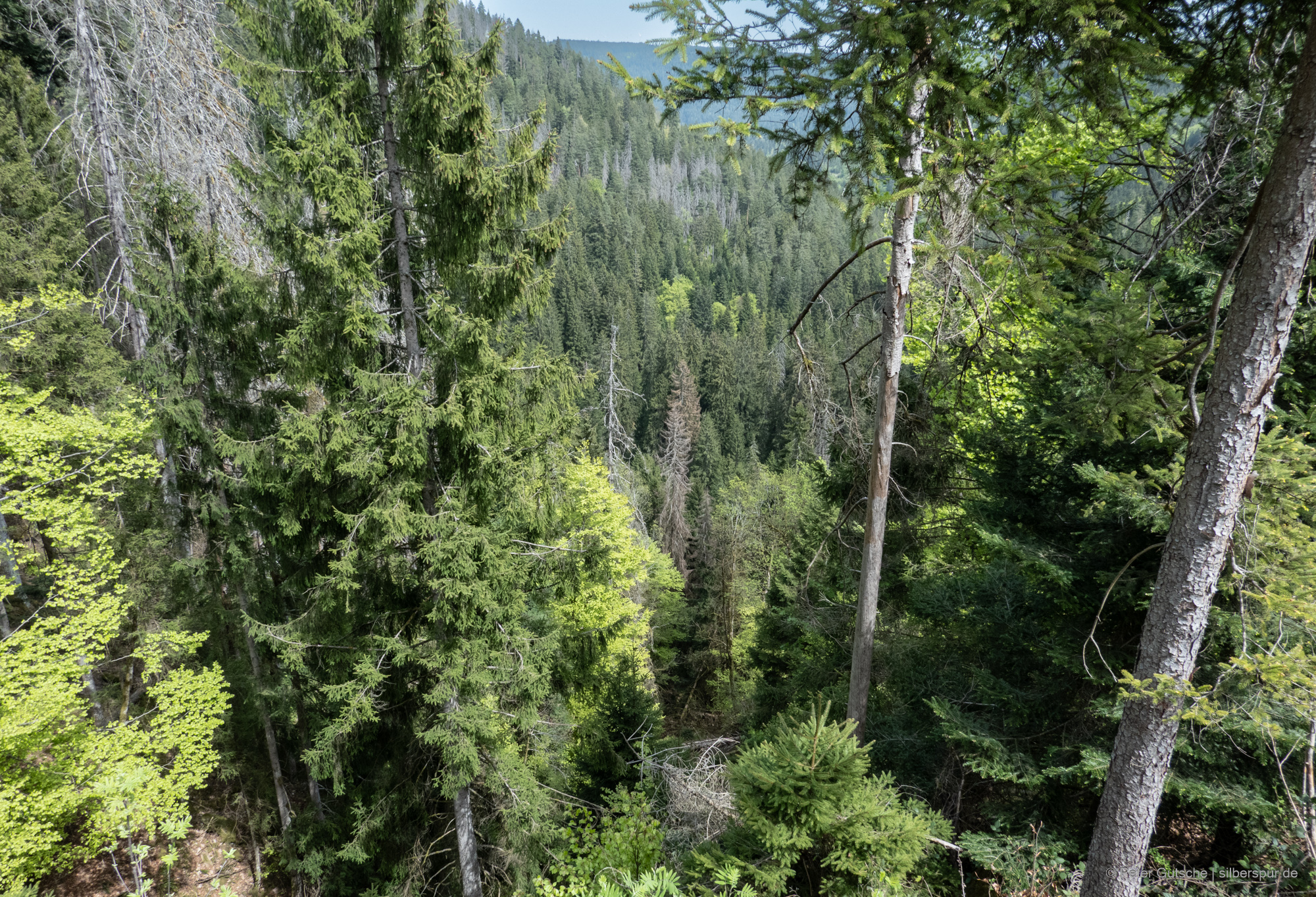
The Schwarzmiss ground is today dried out and covered with dense forest.
The following photograph shows the Schurmsee in northern Black Forest.
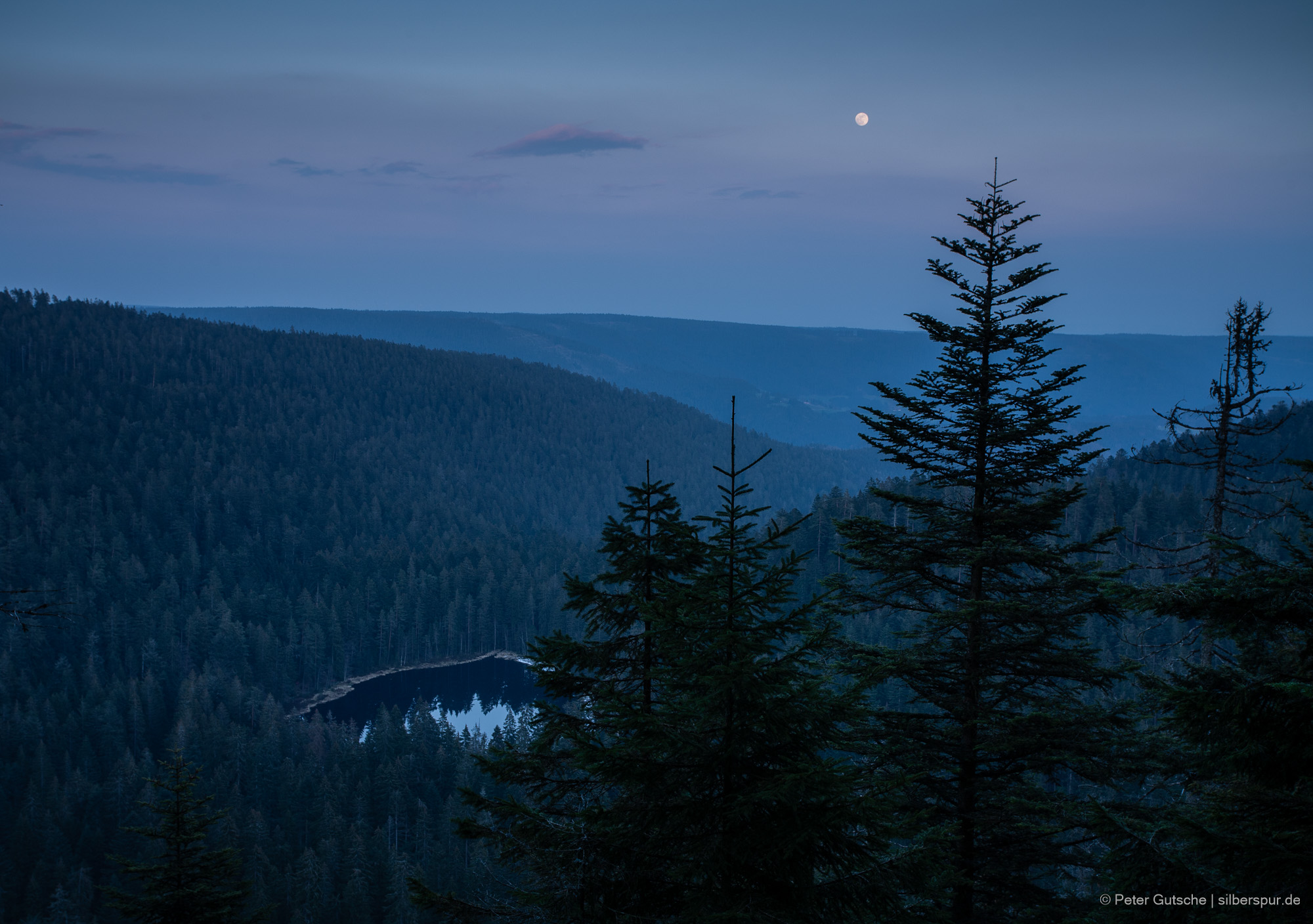
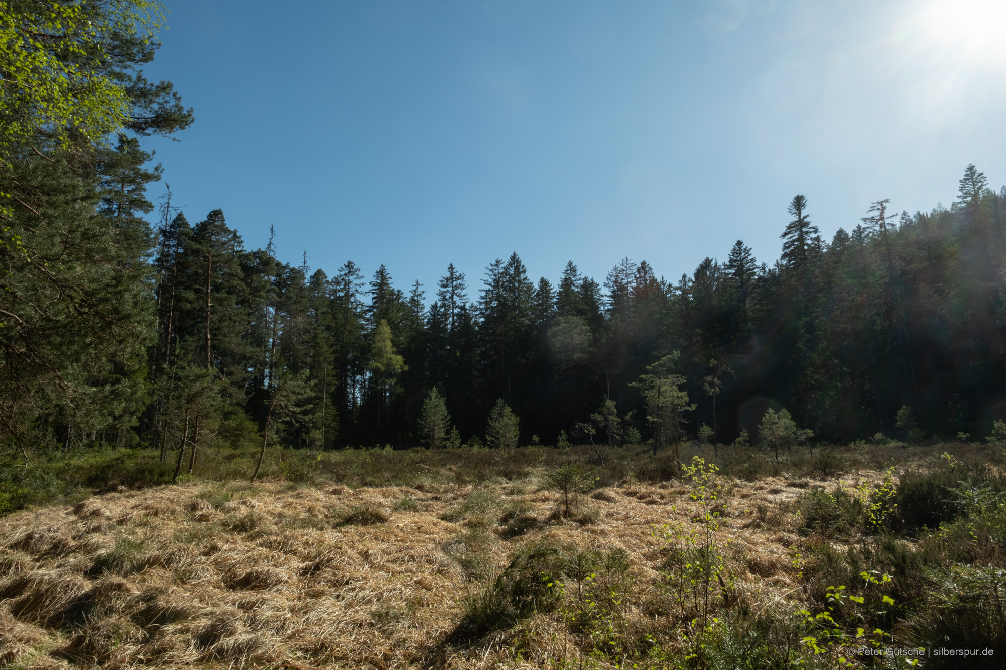
Near Schurmsee lies a cirque named Blindsee (translates to: blind lake; see map below). It likely once held a lake, thousands of years ago.
Landscape changes during the Holocene
The German geographer Fritz Fezer (1924 – 2018) has studied and documented the cirques and tarns in the northern Black Forest in great detail. Based on countless site inspections, he classified all cirques along geomorphological criteria and documented his findings in an article in 1957. (Learn more)
In doing so, he inferred, for example, from the degree of preservation of the moraine the likelihood that a cirque that has since dried out was filled with water in the past.
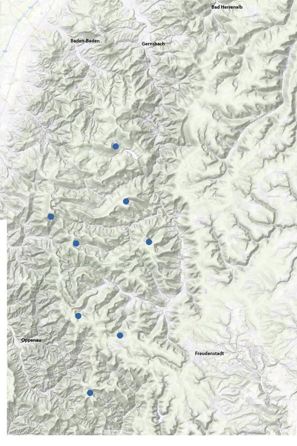
The following figure shows the geographical locations of the tarns that still exist today .
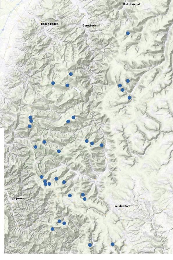
The following figure represents the situation at the beginning of the Holocene several millennia ago (according to the classification of Fezer).
Even though it is difficult to find historical evidence of lakes that have since disappeared, human memory and the knowledge transferred orally from generation to generation may play a role in reconstructing the history of the tarns.
Therefore, Fritz Fezer did not only consider geomorphological criteria in his work, but also historical and other aspects. To get an idea of which of the lakes that existed at the beginning of the Holocene might still have existed during historical time (and have since disappeared), he also considered toponymy. If a cirque had a name that contained a word suggesting the presence of water – for example, Weiher (pond) or See (lake) – in his view, this indicated that a lake still existed in historical times, but has since disappeared. (Learn more):
Fezer wrote in 1957 (Learn more):
The still dark lakes of the Black Forest form a particular attraction. Deeply embedded in the wooded mountains, remote and far away from streets and villages, they surprise the hiker after he has feasted his eyes on the immense Buntsandstein elevations. In similar depressions, at least in spring, he might find puddles of water. On the map, there are names such as 'Blinder See' or 'Weiher'. They indicate that some few centuries ago a lake once existed here. The names of other basins contain the word 'Misse', which means 'marshy spot'. But the swamps are today drained and planted with spruce.
On topographic maps of the Black Forest, you often find locations with a name containing the word 'misse'. As Fezer writes, this word possibly had the meaning 'marshy spot' or 'moor'. It also can have its origin in the Early New High German '-miss' with the meaning 'bad' or 'lousy'. Cf. Early New High German online dictionary at https://fwb-online.de/.
Furthermore, in his work, the aspect of personal memory is of a certain importance – for example, when Fezer reports about the cirque Alter Weiher near Freudenstadt in the following way (Learn more):
In the description of the Freudenstadt district (Oberamt Freudenstadt) published in 1858, the lake is described as a silted-up, 'amphitheater-shaped basin' and is referred to as 'a peat bog overgrown with moss'. However, an elderly resident of Reinerzau told me that during his youth there was still an open pool with an area of approximately 10 $m^2$. Today, this pool has shrunk to about 1 $m^2$ and is covered by a floating peat mat.
The elderly resident mentioned by Fritz Fezer might have been an adolescent end of the 19th century.
The botanist Gerhard Lang (1924 – 2016) writes about the Alter Weiher cirque (referring to Fritz Fezer): (Learn more)
The remotely located and difficult to access Alte Weiher is, according to Fezer (1957), one of the most beautiful cirques in the northern Black Forest – at least in terms of geomorphology …
Referring to the hydrogeographer Wilhelm Halbfaß (1856 – 1938), Gerhard Lang continues:
The boggy soil is still so spongy today that a seven-meter-long pole can be pushed in effortlessly and a grazing cow is said to have sunk in it just 20 years back.
A modern view on cirque studies
Up to this point, I have referred primarily to the somewhat older work of Fritz Fezer. Without intending in any way to diminish this significant achievement, a note from today's perspective is nevertheless appropriate.
To determine whether a lake had existed in a cirque during historical or prehistoric times, Fezer applied a range of criteria drawn from different disciplines, including geomorphology, toponymy, and oral tradition. I have followed his line of argument and sought to highlight the plausibility of his conclusions.
In the interest of scientific rigor, however, it should be emphasized that these plausible conclusions do not constitute sufficient proof that a particular cirque contained a lake during historical or prehistoric times.
To answer this question reliably for such a location, sediment cores would need to be obtained from the floor of the cirque. The discovery of lacustrine sediments, particularly varved deposits, would provide reliable evidence for the former existence of a lake. To my knowledge, such investigations have not been carried out for all cirques in the Black Forest and the Vosges. Consequently, the question cannot yet be answered with conclusive evidence, and the map presented above (showing the situation at the beginning of the Holocene) should be regarded as a plausible, but ultimately unproven, hypothesis. They remain valid unless they are falsified by evidence from a specific cirque.
I would like to thank geologist and geomorphologist Dr. Felix Martin Hofmann of the University of Freiburg (Freiburg im Breisgau, Germany) for generously sharing his insights in a personal communication. (Learn more)
In the following blogpost, we get to know the glacial cirque lakes as landscape archives.
Bibliography
- Bertrand, P., Legendre, L., 2021. Earth, our living planet: the earth system and its co-evolution with organisms, 1st ed. 2021. ed, The Frontiers collection. Springer international publishing, Cham.
- Fezer, F., 1957. Eiszeitliche Erscheinungen im nördlichen Schwarzwald. Selbstverlag der Bundesanstalt für Landeskunde. URL
- Fezer, F., 1971. Zur quartären Formung des Nordschwarzwaldes. jber_oberrh 53, 183–194. URL
- Fezer, F., Günter, W., Reichelt, G., 1961. Plateauverfirnung und Talgletscher im Nordschwarzwald. URL
- Ganopolski, A., Winkelmann, R., Schellnhuber, H.J., 2016. Critical insolation–CO2 relation for diagnosing past and future glacial inception. Nature 529, 200–203. URL
- Hofmann, F.M., 2025. Landscape Evolution of the Black Forest: From the Variscan Orogeny to the Modern Era, in: Lehmkuhl, F., Böse, M., Krautblatter, M. (Eds.), Landscapes and Landforms of Germany, World Geomorphological Landscapes. Springer Nature Switzerland, Cham, pp. 301–313. URL
- Hofmann, F.M., Vorwerg, L., Witschel, R., 2025. Refining the mapping of cirques and moraines in the central and northern Black Forest, south-west Germany, with remote sensing data and cirque metrics extraction. jgeomorphology 2, 41–66. URL
- Jänichen, H., 2026. Historischer Atlas von Baden-Württemberg: Beiwort zu den Karten 4, 1–2, Der alemannische und fränkische Siedlungsraum.
- Lang, G., 2005. Seen und Moore des Schwarzwaldes - als Zeugen spätglazialen und holozänen Vegetationswandels. Staatliches Museum für Naturkunde Karlsruhe, Karlsruhe. URL
- Prud’homme, C., Fischer, P., Jöris, O., Gromov, S., Vinnepand, M., Hatté, C., Vonhof, H., Moine, O., Vött, A., Fitzsimmons, K.E., 2022. Millennial-timescale quantitative estimates of climate dynamics in central Europe from earthworm calcite granules in loess deposits. Commun Earth Environ 3, 267. URL
- Schwarzbach, M., Wolstedt, P., 1967. Eiszeitalter und Gegenwart: Jahrbuch der Deutschen Quartärvereinigung. Hohenlohe’sche Buchhandlung Ferd. Rau, Öhringen, Württemberg. URL
- Zienert, A., Fezer, F., 1967. Vogesen- und Schwarzwald-Kare. E&G Quaternary Sci. J. 18, 51–75. URL
Related Entries


